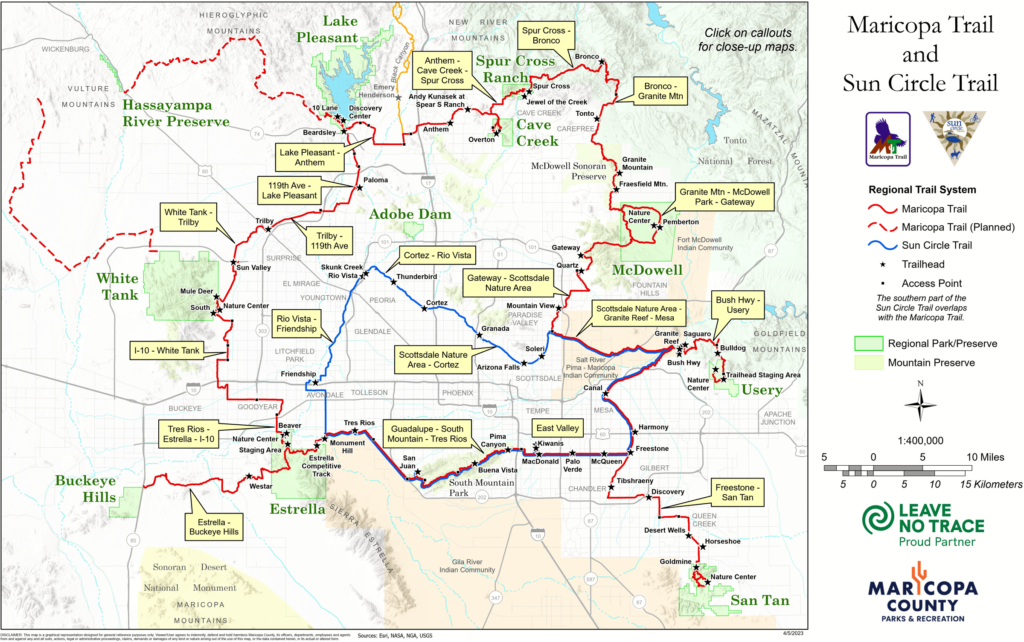
Maricopa Trail Map
The Maricopa Trail connects 10 Maricopa County Regional parks over a 315-mile scenic, diverse route.
Proposed Trail Map
The Maricopa Trail connects 10 Maricopa County Regional parks over a 315-mile scenic, diverse route.

Detailed Color Maps
Click to view individual trails in more detail.
Northern
Eastern
Printer-friendly Maps
Click to view black-and-white maps you can print out and take with you on the trail.
Overview
Maricopa Trail & Sun Circle Trail
